Video Clips
Quoted moments from Alaska public meetings, hearings, and press conferences.
Zoe Kaplan
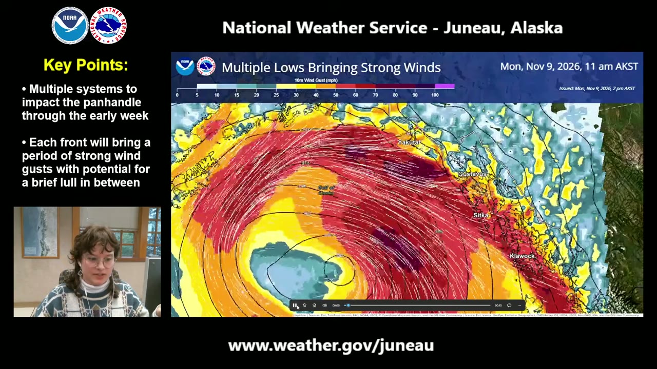
“We have a very strong swath of winds that's just off the coast right now, and that's going to continue overnight and just continue to move west. And we have another low that's going to be jumping up into the southern Panhandle through the early morning on Tuesday.”NWS Juneau: Multiple Systems to Impact the Panhandle Early Week | November 9th, 2026 ·
Zoe Kaplan
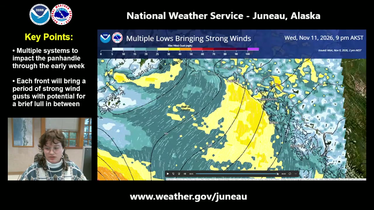
“We're going to keep putting out more updates as this— with this— these systems as it gets closer.”NWS Juneau: Multiple Systems to Impact the Panhandle Early Week | November 9th, 2026 ·
Zoe Kaplan
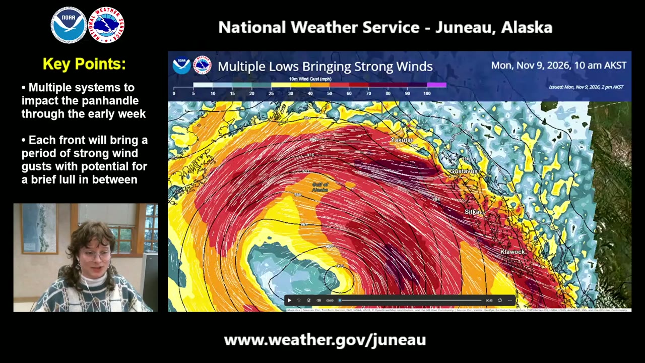
“through the entirety of the early week, we're pretty much having low after low hit the Panhandle. We have a low pressure system in the Gulf right now”NWS Juneau: Multiple Systems to Impact the Panhandle Early Week | November 9th, 2026 ·
Britten Musall
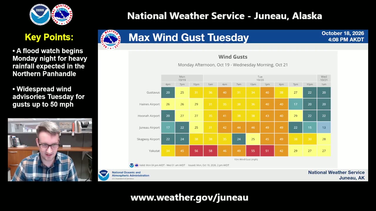
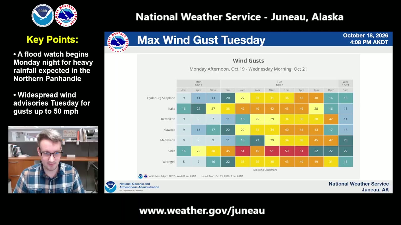
“The initial front is going to arrive late tonight in Yakutat, think between about 10 PM, I think around 10 PM or so. That'll be the initial wave of winds. And then again, that early Tuesday morning— or excuse me, mid-morning Tuesday through early afternoon, potentially some gusts a little higher than 55 miles an hour.”NWS Juneau: Heavy Rainfall Tuesday | October 20, 2026 ·
Britten Musall
“Sitka, expect those winds to arrive around 3, 4 o'clock in the morning with that initial wave, and then that secondary wave similar timing to Yakutat, think mid-morning through early afternoon.”NWS Juneau: Heavy Rainfall Tuesday | October 20, 2026 ·
Britten Musall
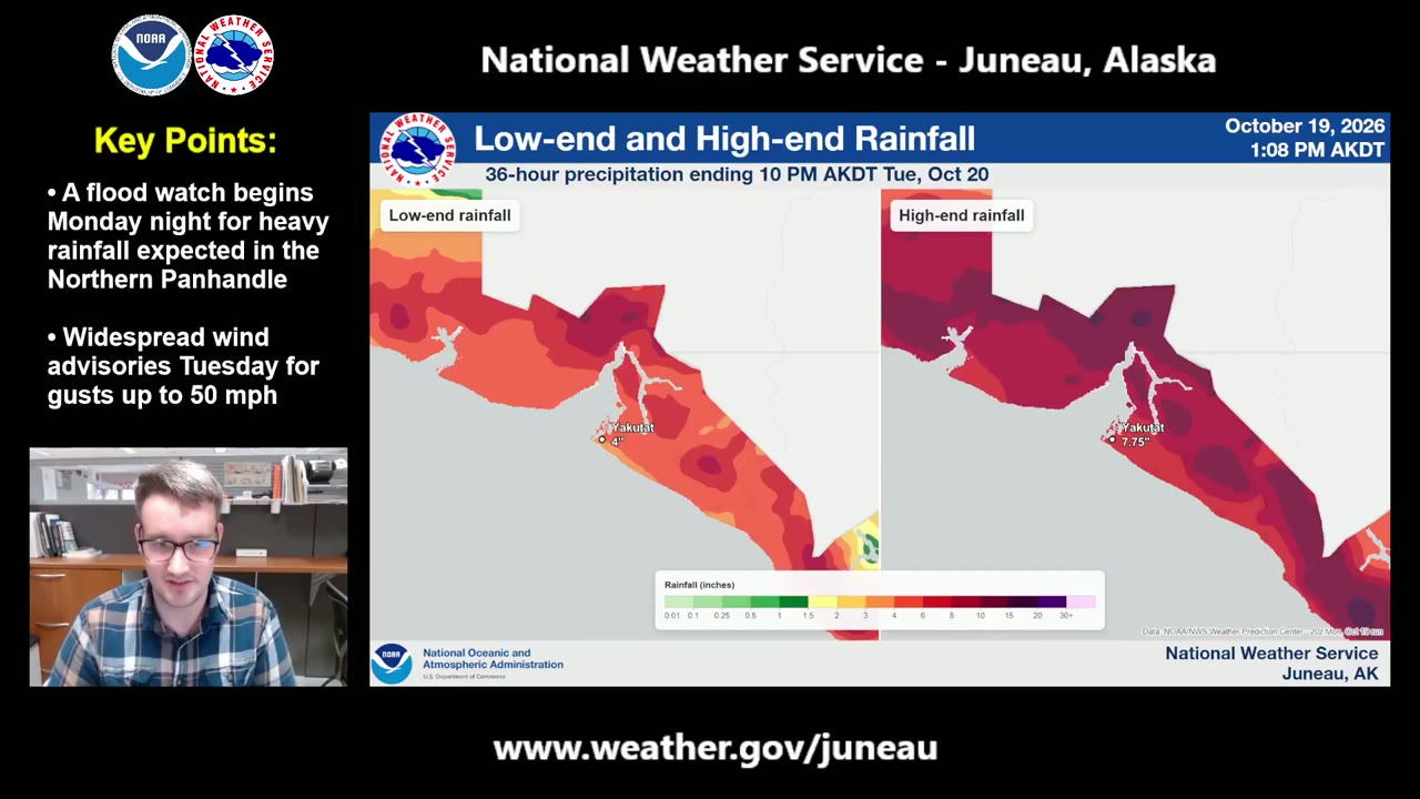
“between 4 to 8 inches possible in Yakutat with this strong low pressure system. 1 To 3 inches possible for places like Juneau, Gustavus, Elfin Cove, Haines, and Skagway, with a little bit less rainfall expected across the southern Panhandle.”NWS Juneau: Heavy Rainfall Tuesday | October 20, 2026 ·
Britten Musall
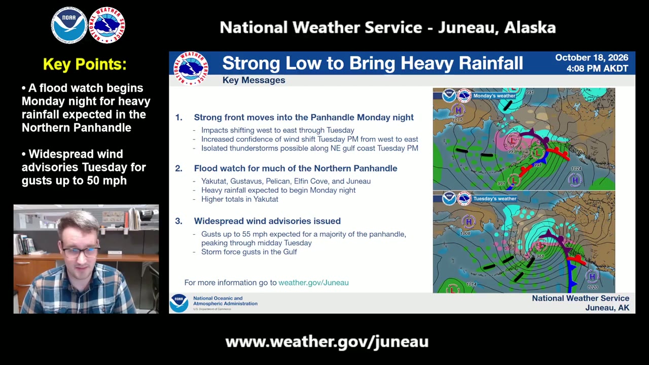
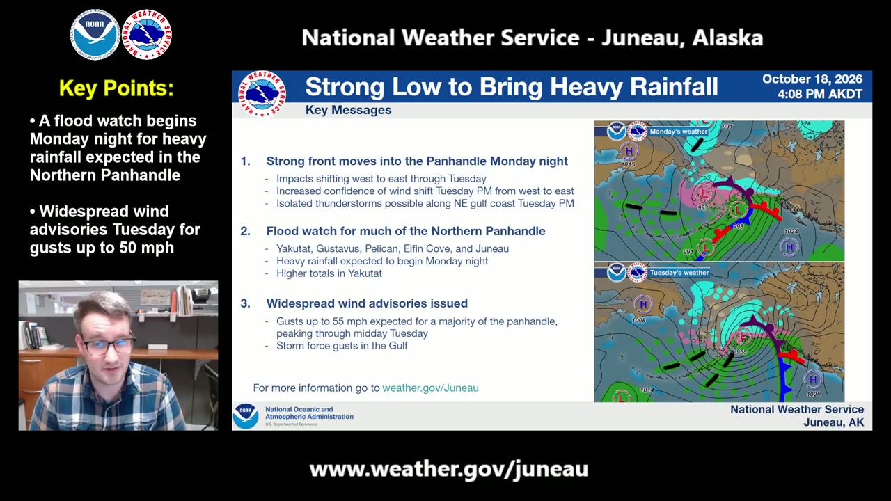
“Yakutat, Gustavus, Pelican, Elfin Cove, and Juneau all included in the flood watch, with the heavy rain expected to begin tonight.”NWS Juneau: Heavy Rainfall Tuesday | October 20, 2026 ·
Britten Musall
“A strong front is going to move into the Panhandle tonight, and impacts with that system are going to shift from west to east through the day Tuesday.”NWS Juneau: Heavy Rainfall Tuesday | October 20, 2026 ·
Nick Morgan
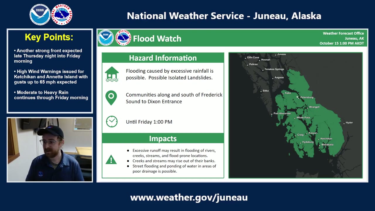
“We still have a flood watch across majority of the southern Panhandle in effect through Friday afternoon. Flooding caused by excessive rainfall is possible. We're seeing some areas you know, near Ketchikan and Annette Island potentially seeing up to 4 to 6 inches of rainfall over the next 24 hours or so.”NWS Juneau: Strong End of Week System | October 15th, 2026 ·
Nick Morgan
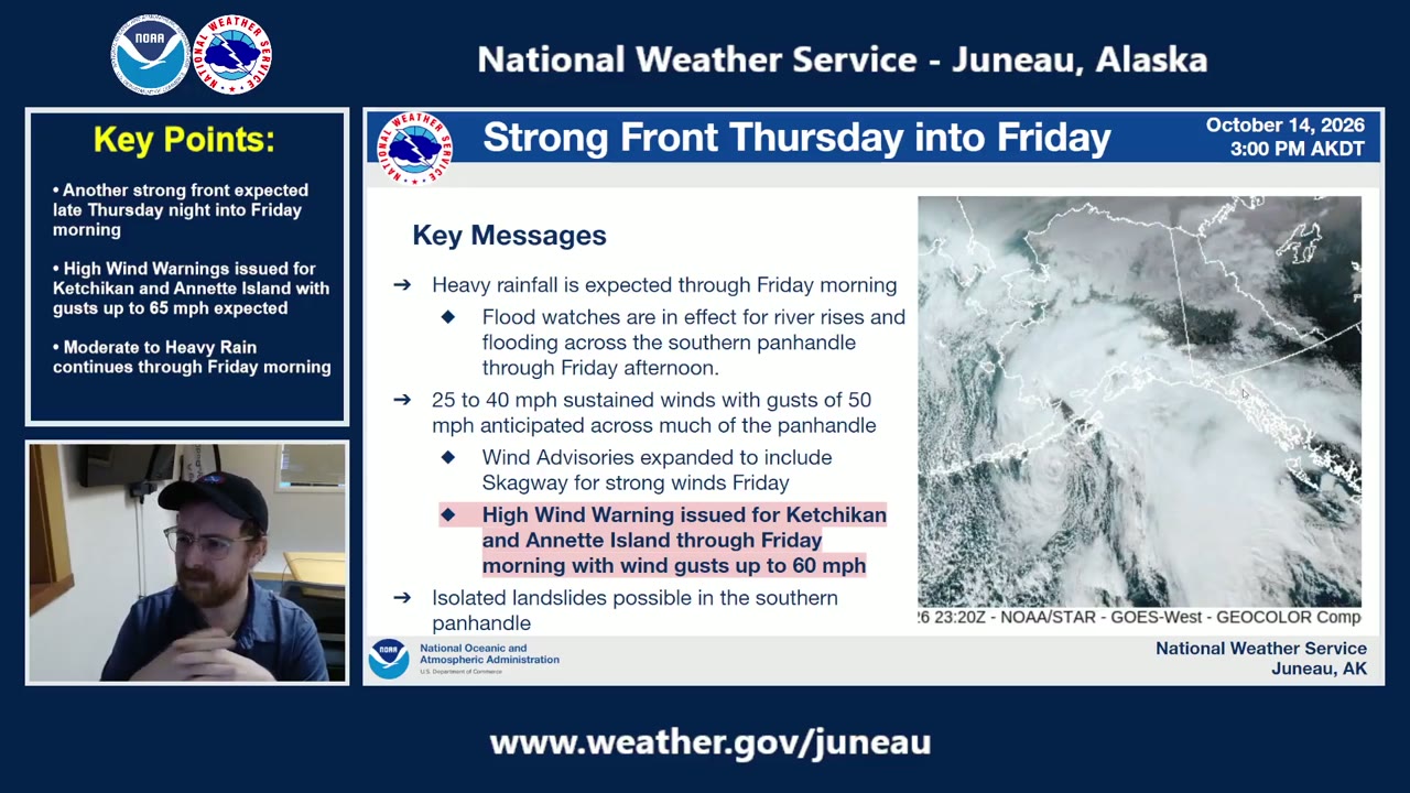
“we're seeing sustained winds around 25 35 to 40 miles per hour with gusts of 50 widespread across the Panhandle.”NWS Juneau: Strong End of Week System | October 15th, 2026 ·
Nick Morgan
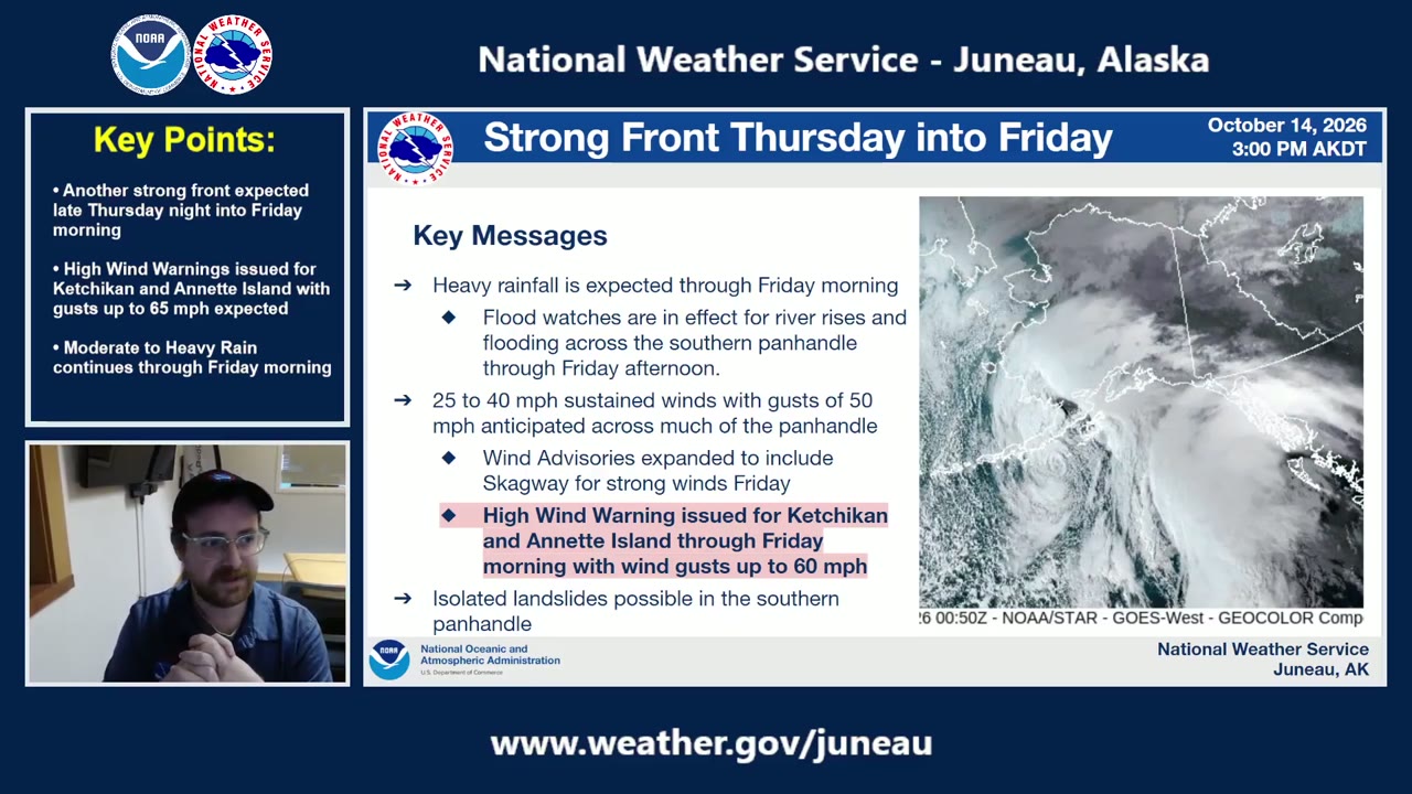
“heavy rainfall still expected through Friday morning. You can see we have this nice low pressure system just south of the Alaska Peninsula sending up this nice plume of moisture straight into the Southeast Panhandle.”NWS Juneau: Strong End of Week System | October 15th, 2026 ·
Nick Morgan
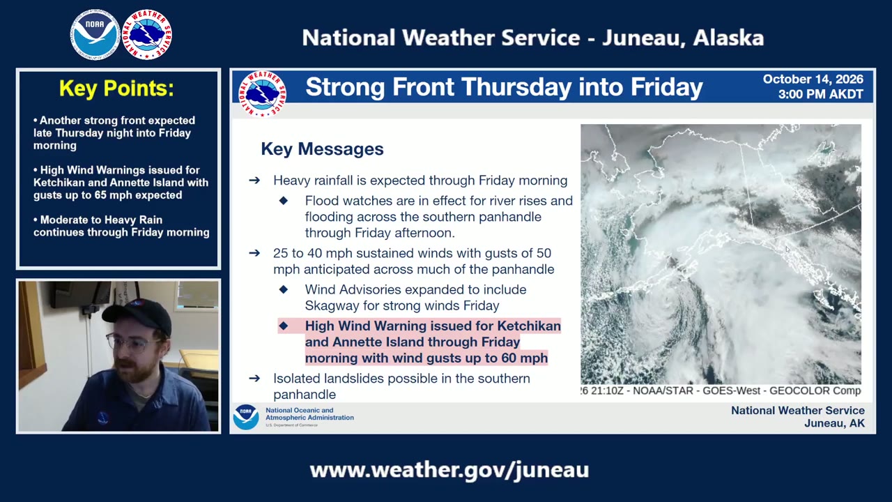
“we do have some wind advisories out for the Juneau area, Baranof, and Sitka as well.”NWS Juneau: Strong End of Week System | October 15th, 2026 ·
Nick Morgan
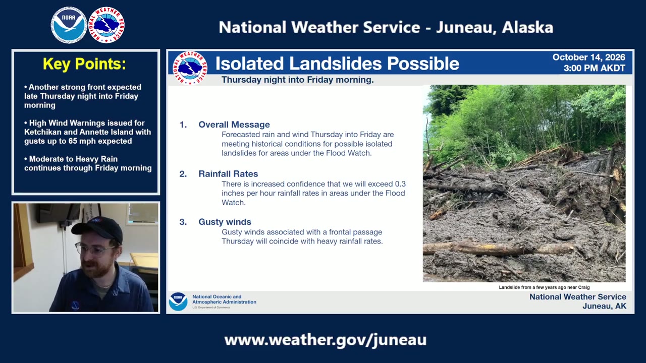
“with this combination of moderate to heavy rain and these elevated winds, historically speaking, these do meet conditions for possible isolated landslides for those areas that are under the flood watch.”NWS Juneau: Strong End of Week System | October 15th, 2026 ·
Nick Morgan
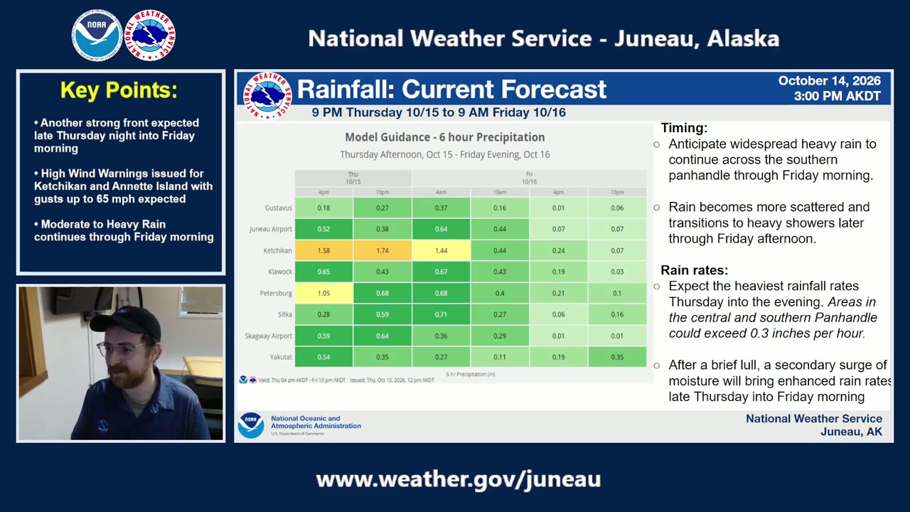
“Ketchikan and the Petersburg area seem to be the winner, uh, through the next, you know, 12 hours. We'll likely see, you know, 3 inches according to this guidance, potentially a little bit higher at the elevations”NWS Juneau: Strong End of Week System | October 15th, 2026 ·
Nick Morgan
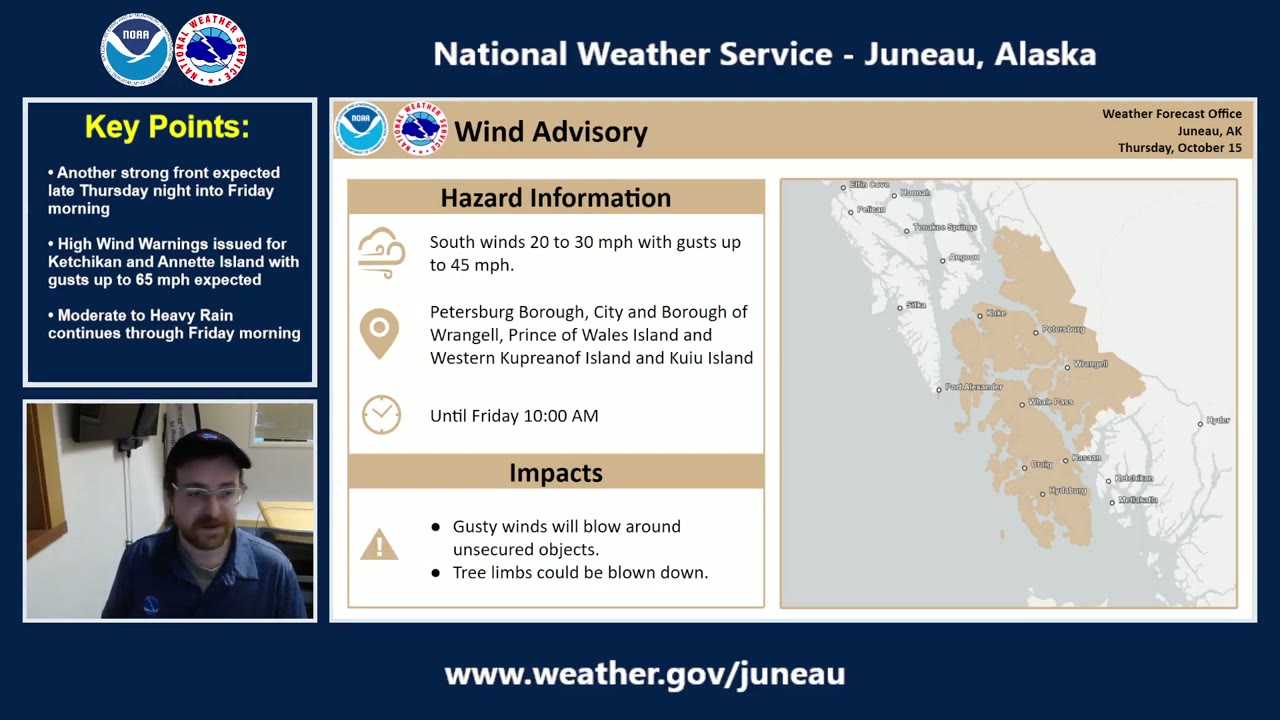
“for Prince of Wales, Wrangell, Petersburg, western Cooper Knopf, and Cooey, we're still thinking that, you know, we will see some gusty winds continuing overnight through Friday morning, uh, sustained winds around 20 to 30 miles per hour with some gusts up to 45.”NWS Juneau: Strong End of Week System | October 15th, 2026 ·
Nick Morgan
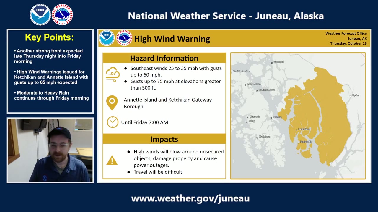
“we have upgraded the wind advisories and now have high wind warnings issued for the Annette Island and Ketchikan Gateway Borough area. That is in effect now until Friday at 7 o'clock in the morning. So we're going to see some sustained winds 25 to 35 miles per hour with those southeasterly gusts reaching potentially 60. And like we just talked about, you could see some gusts up to 70, 75 miles per hour at elevations greater than 500 feet.”NWS Juneau: Strong End of Week System | October 15th, 2026 ·
Nick Morgan
“it's going to be wet, it's going to be windy, and that's going to continue through Friday morning. However, as we get into Friday afternoon into Saturday, we'll start to see some bit of a break potentially. However, we are keeping our eye on another system that could potentially move into the Panhandle by early next week”NWS Juneau: Strong End of Week System | October 15th, 2026 ·
Nick Morgan
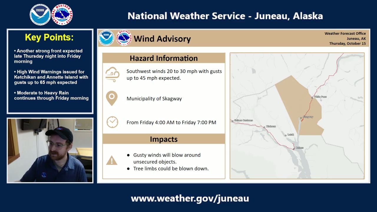
“we have issued a wind advisory for Skagway on the tail end of things. So by 4 AM on Friday, Skagway winds will start to be increasing, and that's going to continue through much of Friday.”NWS Juneau: Strong End of Week System | October 15th, 2026 ·
Nick Morgan
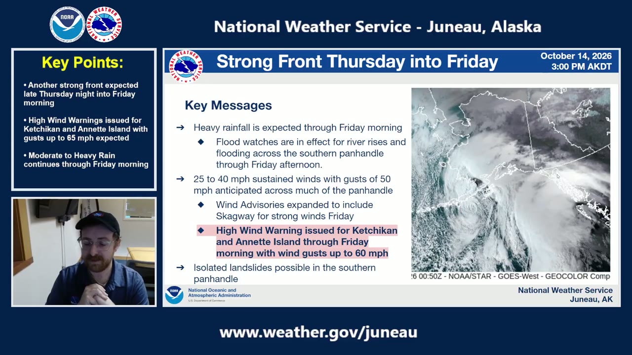
“we have issued a high wind warning for Ketchikan and Annette Island through Friday morning with wind gusts up 60 miles per hour expected, potentially some wind gusts up to 70, uh, at elevations around 1,000 feet, 500 feet or less. And still messaging the possibility of isolated landslides in the southern Panhandle in that combination of moderate to heavy rainfall and those 40 to 60 mile per hour wind gusts.”NWS Juneau: Strong End of Week System | October 15th, 2026 ·
Zoe Kaplan
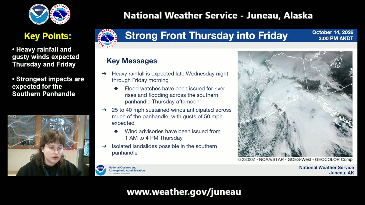
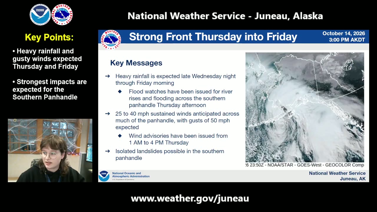
“25 to 40 miles per hour sustained winds anticipated across much of the Panhandle, with winds in some of our stronger areas around Clarence Strait and out Icy Strait corridor and Cross Sound expecting closer to 45 miles per hour, with gusts up to 50 miles per hour expected for some of these land areas. So wind advisories have also, also been issued for parts of the southern Panhandle. And this is also indicating the possibility of isolated landslides for parts of the southern Panhandle.”NWS Juneau: Heavy Rain and Strong Winds Thursday | October 14th, 2026 ·
Zoe Kaplan
“we're expecting heavy rainfall starting late Wednesday night for the far southern Panhandle and moving north to northeastward into the rest of the Panhandle through Thursday morning, and that will continue into Friday morning. So flood watches have been issued for this time frame for parts of the southern and central Panhandle.”NWS Juneau: Heavy Rain and Strong Winds Thursday | October 14th, 2026 ·
Zoe Kaplan
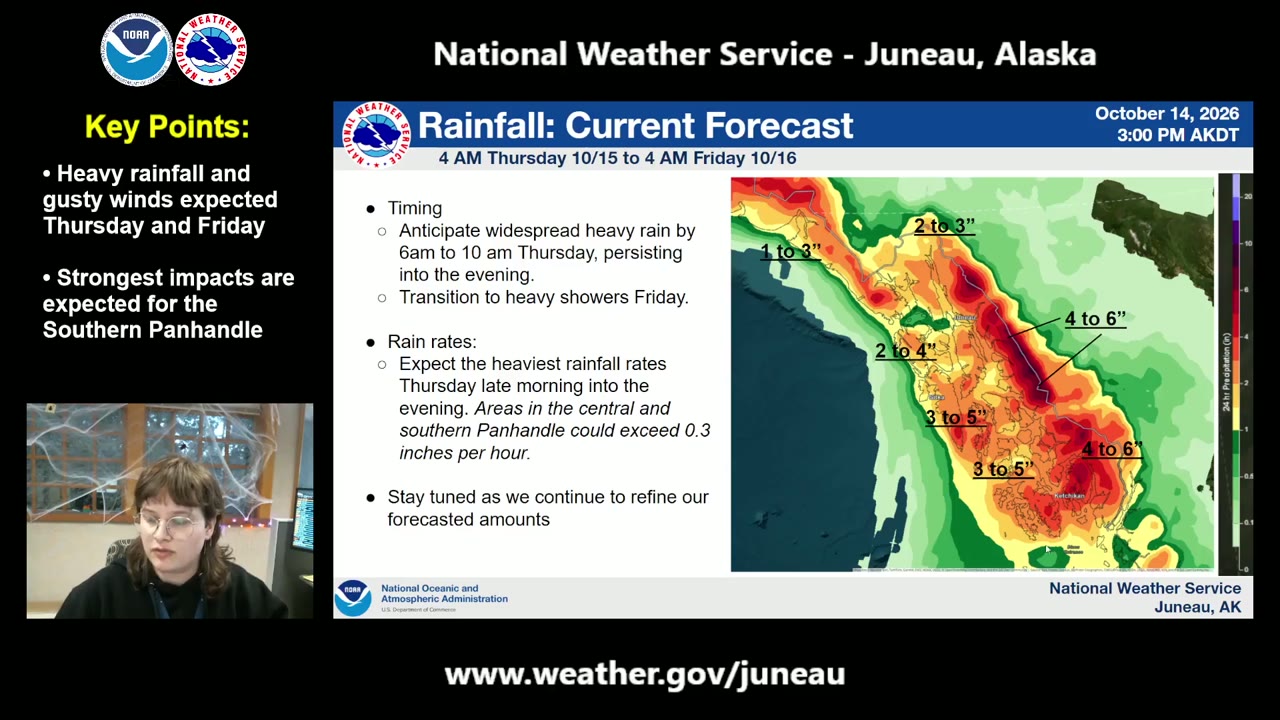
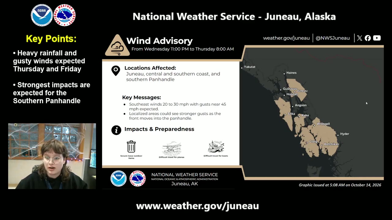
“we are expecting this heavy rainfall from, uh, on Thursday morning around 6 AM to 10 AM timeframe, and that is going to persist into the evening, but that is the timeframe of the heaviest rainfall that we're expecting. And these rain rates could exceed 0.3 inches per hour during this timeframe. And this is our wind advisory that we have out. This is for much of the southern Panhandle as well as for Juneau and parts of the outer coast.”NWS Juneau: Heavy Rain and Strong Winds Thursday | October 14th, 2026 ·
Zoe Kaplan
“this is also why we have been looking into the possibility of isolated landslides, and so we will continue messaging this possibility as we as we get closer to the event and we learn a little more. And so you can continue to check back at our forecast at weather.gov/juno, and we will try to update you within, within the next few hours.”NWS Juneau: Heavy Rain and Strong Winds Thursday | October 14th, 2026 ·

Ginu Nidolny
“major flood stage and the peak crest is expected to be tonight, so at darkness. That challenges our ability to, to see, to see risks.”Juneau: August 12, 2026 Unified Command GLOF Press Briefing ·

Ginu Nidolny
“The best thing this community and the citizens can do to maintain their safety is to evacuate as the city has recommended. Again, that's an evacuation request by 3— no later than 3 PM today.”Juneau: August 12, 2026 Unified Command GLOF Press Briefing ·

Ken Murphy
“Slow is fast. Slow down. Take your time. If you're evacuating, thank you.”Juneau: August 12, 2026 Unified Command GLOF Press Briefing ·

Nicole Barron
“We issued the flood warning yesterday afternoon for an expected crest tomorrow morning between 16.1 and 16.6 feet. Rough timeline of when that crest would happen is Thursday morning between 5:00 AM and 9:00 AM.”Juneau: August 12, 2026 Unified Command GLOF Press Briefing ·

Brian O'Shaughnessy
“We're tremendously confident in the HESCO barriers. We're tremendously confident in the pumps that the U.S. Army Corps of Engineers has provided. None of this is worth betting your life. Please evacuate.”Juneau: August 12, 2026 Unified Command GLOF Press Briefing ·

Brian O'Shaughnessy
“We're talking about tens of thousands of cubic feet of water per second.”Juneau: August 12, 2026 Unified Command GLOF Press Briefing ·

Juneau: August 12, 2026 Unified Command GLOF Press Briefing ·

Nicole Barron
“In the event, unlikely event, of a Hesco barrier breach during that major flood stage, our office would coordinate with the Unified Command and issue a flash flood warning. If you did get a flash flood warning, all of your phones would go off for that if you were in the evacuation area, and we would ask that you shelter in place”Juneau: August 12, 2026 Unified Command GLOF Press Briefing ·

Brian O'Shaughnessy
“we anticipate there's an average of around 2.5 folks per dwelling. We have around 2,000 residences in the area, so that would come out to around 5,000 folks.”Juneau: August 12, 2026 Unified Command GLOF Press Briefing ·

Brian O'Shaughnessy
“We're asking folks to finish their evacuation preparations and procedures by 3:00 PM this afternoon as, as they move through this period. Capital Transit will be running until 5:00 PM this afternoon to assist with anyone who's utilizing Capital Transit in their evacuation plan.”Juneau: August 12, 2026 Unified Command GLOF Press Briefing ·

Brian O'Shaughnessy
“in the event of a HESCO failure, folks would only have minutes before the area could be inundated. This could potentially be a truly massive amount of water coming through... folks would not have time to evacuate. That flash flood warning product would contain the instructions of shelter in place.”Juneau: August 12, 2026 Unified Command GLOF Press Briefing ·

Loren Joseph
“We have trailer supplies on site for 50. The gym probably maxes out around 75 people. We could get a little bit more if needed.”Juneau: August 12, 2026 Unified Command GLOF Press Briefing ·

Nicole Barron
“Looking ahead, we expect major flood stage later overnight after midnight. And that will last for approximately an 8-hour period. Major flood stage is 14 feet on the lake gauge.”Juneau: August 12, 2026 Unified Command GLOF Press Briefing ·

Brian O'Shaughnessy
“We do not have active tracking of who's evacuated or who hasn't evacuated. And again, this is one of the primary reasons that we're asking folks to self-evacuate before the event.”Juneau: August 12, 2026 Unified Command GLOF Press Briefing ·

Loren Joseph
“We established a shelter at Floyd Grind Gym last night. We had a family of 6 overnight.”Juneau: August 12, 2026 Unified Command GLOF Press Briefing ·

Travis Eckhoff
“we will close the back loop bridge at 8:30 PM tonight, and we will be closing the pedestrian paths on the Brotherhood Bridge around 5:15, or when the lake gauge hits 10 feet.”Juneau: August 12, 2026 Unified Command GLOF Press Briefing ·

Juneau: August 12, 2026 Unified Command GLOF Press Briefing ·

Juneau: July 9, 2026 CBJ Media Availability ·

Juneau: July 9, 2026 CBJ Media Availability ·

Juneau: July 9, 2026 CBJ Media Availability ·

Juneau: July 9, 2026 CBJ Media Availability ·

Juneau: July 9, 2026 CBJ Media Availability ·

Juneau: July 9, 2026 CBJ Media Availability ·

Juneau: July 9, 2026 CBJ Media Availability ·

Juneau: July 9, 2026 CBJ Media Availability ·