17:49 - 18:24
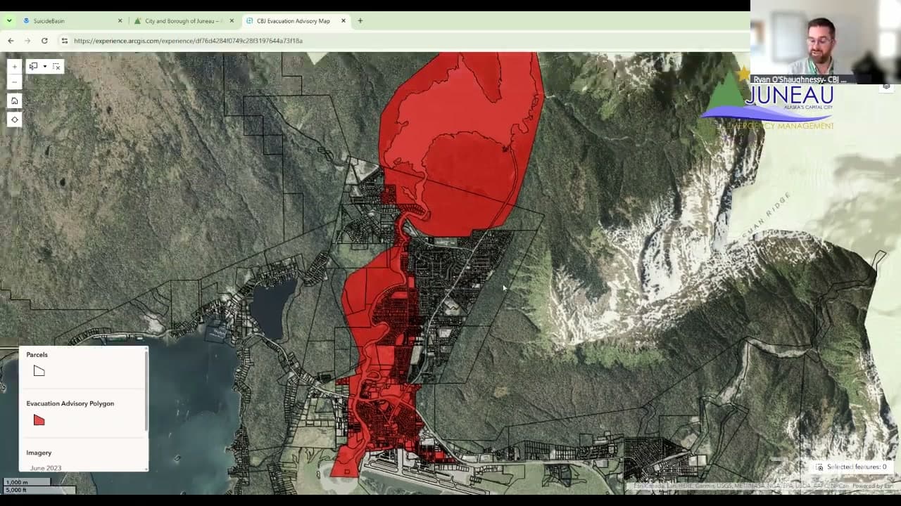
"last year we strictly used inundation maps to guide evacuation notice,. And this year we've broadened our perspective a little bit. We saw, we did see ponding last year behind some of the HESCO barriers and to take into account where roads may become blocked and access may be limited by first responders or those evacuating, we've broadened our criteria for the evacuation area a little bit."
“last year we strictly used inundation maps to guide evacuation notice,. And this year we've broadened our perspective a little bit. We saw, we did see ponding last year behind some of the HESCO barriers and to take into account where roads may become blocked and access may be limited by first responders or those evacuating, we've broadened our criteria for the evacuation area a little bit.”
- Timestamp
- 17:49 – 18:24
- Community
- Alaska News
- Location
- Juneau
- Captured at
- July 9, 2026
From the transcript
Again, the reason for that, last year we strictly used inundation maps to guide evacuation notice,. And this year we've broadened our perspective a little bit. We saw, we did see ponding last year behind some of the HESCO barriers and to take into account where roads may become blocked and access may be limited by first responders or those evacuating, we've broadened our criteria for the evacuation area a little bit. So again, the southern part of the valley and the, it's a little bit wider around the river. To answer the second part of your question, how will folks be notified?
Related Coverage
Nearly 1,900 Juneau homes are under an evacuation advisory as a glacial flood nears
Nearly 1,900 Juneau homes in the Mendenhall Valley are under an evacuation advisory as Suicide Basin nears a major glacial outburst flood expected between about Aug. 1 and 9.
 by Alaska News1mo ago2 min readAI