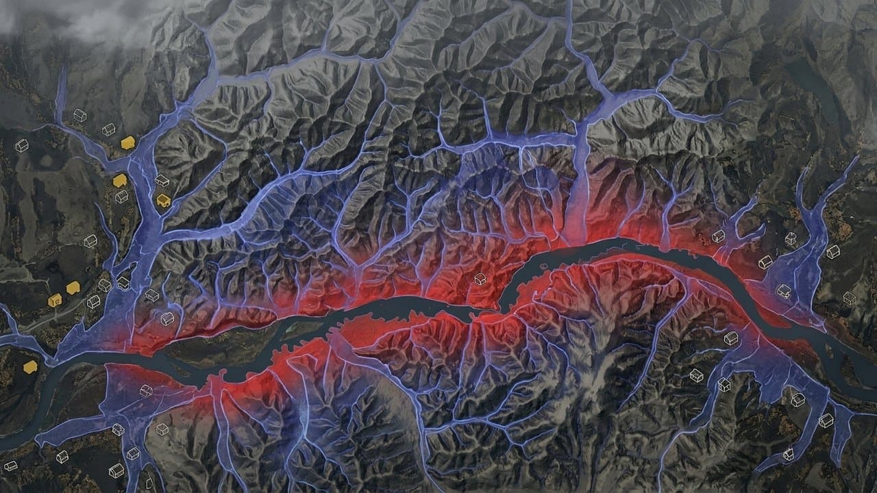
Editorial map (Gemini + Google Maps)
Fairbanks gets new flood maps in January, and most homes in the zone are uninsured
Most of the Fairbanks North Star Borough has been working from flood maps drawn in 1992. New federal maps redrawing where the flood zone runs take effect Jan. 8, and for anyone whose property lands inside one, the practical consequence is insurance: a federally backed mortgage on a home in a high-risk flood zone requires it.
Almost nobody there has it now. FEMA counted 1,707 homes inside the borough's mapped flood zone this summer and 444 flood insurance policies covering them, which is roughly one in four. Juneau, the only Alaska borough with more policies, covers about 88 percent of the homes in its own flood zone. Nothing in the federal record explains the difference.
The old map looked at three sources of flooding: the Chena River, the Little Chena and Noyes Slough. The new study looks at about 35, adding the Chatanika River, Goldstream Creek and more than a dozen unnamed tributaries. It resets the zone boundaries, the height floodwater is expected to reach, and the channels that have to stay clear for that water to pass.
It also models what happens under future conditions rather than current ones. Above Moose Creek Dam, the flood the study expects to have a one-in-a-hundred chance of occurring in any future year is larger than what today's maps call a one-in-five-hundred-year flood.
The borough has a flood history to match. It has logged 244 flood insurance claims since 1978 and paid out about $2.57 million on 173 of them. The worst year was 2008, with 47 claims and $674,339 paid, the same year the borough got a federal disaster declaration. Of four flood-related declarations, only one, in 2002, paid individuals anything. The other three went to repairing public infrastructure.
Some residents are hedging. Of the 438 policies in force across the borough, covering about $106 million in buildings at a median cost of $463 a year, 98 are written on properties outside the flood zone entirely.
The borough's Planning Commission takes up an ordinance Monday that would adopt the new maps and update its floodplain rules. It has to adopt them to stay eligible for the National Flood Insurance Program. The window for appealing the new boundaries has closed.
Property owners who want to know whether their own parcel moves can call the borough floodplain administrator at 907-459-1260. The map panels are also posted on FEMA's Map Service Center.
Source: Federal Emergency Management Agency, Fairbanks gets a new flood map on 8 January, redrawn from 35 streams instead of three, and three out of four homes already in the flood zone have no insurance.
Made by our human newsroom with AI. How humans and AI work here · Grow with our newsroom
Stay informed. Support what matters.
Free, permanent access to local news you can verify. Subscribe to support Walter AlaskaNews and go ad-free.
Watch the short version
Related Coverage
New flood maps would end mandatory flood insurance for thousands of Fairbanks properties
Alaska News · 1mo ago
Fairbanks flood maps are final. Borough page still points to appeals
Alaska News · 1mo ago
State and FEMA offer free training for Alaska's local floodplain officials
Alaska News · 1d ago
Fairbanks rewrites Chena riverfront rules; its own 2019 warning was never acted on
Alaska News · 1mo ago
Fairbanks subcommittee drafts new Chena River plan with freeze, salmon, and flood goals
Alaska News · 3mo ago
Comments
Sign in to leave a comment.
No comments yet. Be the first to share your thoughts.