AI image
A cable across the Koyukuk, a camp for a mining crew, and no named mine
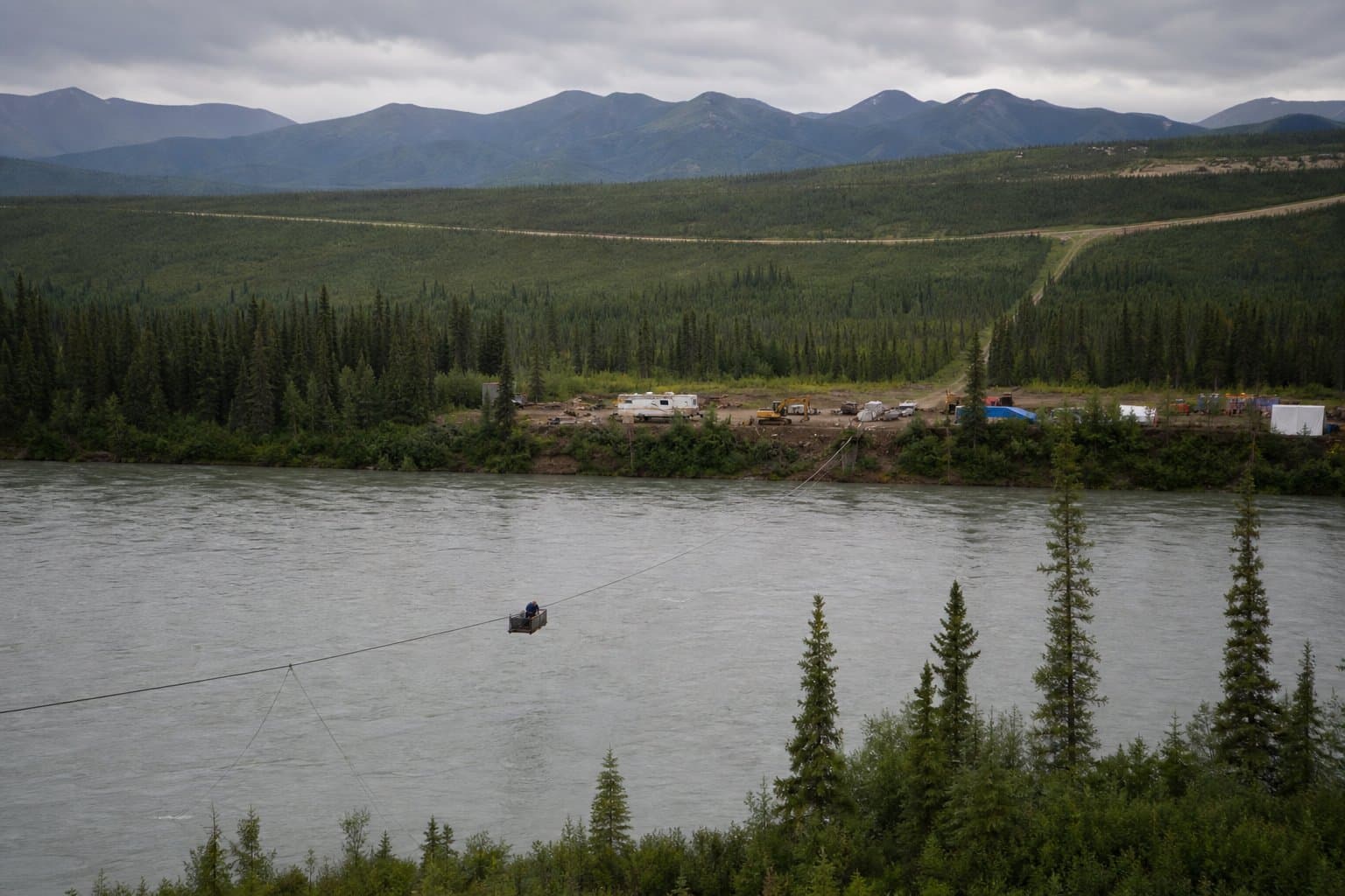
Ash Berringer of Wasilla has applied to string a cable rated to 25,000 pounds across the Middle Fork of the Koyukuk River and put a six-person mining camp on the east bank. The state's file does not say which mine it would serve, and the application form never asks.
The Alaska Department of Natural Resources opened a 14-day comment window Wednesday on the five-year authorization, which runs through 2031 with the camp used May through October.
The cable would carry supplies 30 feet above the water, strung between trees on either bank, roughly 530 feet across. The camp would be three campers, a van trailer and an outhouse inside a cleared area 40 feet by 60 feet, on up to half an acre. Six employees and supervisors would work there. No part of the area would be closed to the public.
The site sits near Chapman Island, reached by Chapman Road off the Dalton Highway near milepost 161. Chapman Island is itself a 40-acre mining claim, in the same section as the proposed crossing.
The Division of Mining, Land and Water describes the purpose in four words. The permit is for a cable and a man camp "to support mining activities." It names no mine, no operator and no claims, and the state's land use permit application does not ask for any. Berringer applied as an individual, checked the box for other commercial or industrial use, left the business license number blank and wrote by hand: camp for mining crew.
State records show 58 active mining claims covering 5,639 acres within about two miles of the proposed camp, held by three parties. A company recorded as 995 Exploration Inc. holds 44 of them, totaling 5,079 acres, all posted in late October of last year. The other 14 are older and lie in the river itself — 10 held by Jeremy Ford and four by Robert Brown, each 40 acres, all recorded in March 2016 and all classified by the state as navigable river bottom.
Berringer holds none of the 58, and nothing in the records connects him to any of the three claim holders. Nothing requires that it would. The permit is for a camp and a cable, not for mining.
The proposal has already shifted once. It was signed June 15 for a camp alone, then amended July 31 to move the camp and add the river crossing. The span is given as 530 feet in the notice, 531 in the application and 510 on the applicant's own drawing.
Written comments are due Sept. 2.
Source: notice.alaska.gov, The state wants comment on a cable across the Koyukuk without saying whose mine it serves. There are 58 claims within two miles.
AI-assisted. How we use AI
Stay informed. Support what matters.
Free, permanent access to local news you can verify. Subscribe to support Walter AlaskaNews and go ad-free.
Related Coverage
A miner wants to run a cable across the Koyukuk and camp on its bank for five years
Alaska News · 1mo ago
A road crew wants to camp in a gravel pit while it fixes the Elliott Highway
Alaska News · 2w ago
A Fox placer miner asked to move Treasure Creek. The state's public notice says equipment and an operator.
Alaska News · 3w ago
DNR opens comment on mining camp proposed near Farewell Airport
Alaska News · 2mo ago
Comment deadline looms on basecamp permit near Denali Highway milepost 86.5
Alaska News · 2mo ago
Comments
Sign in to leave a comment.
No comments yet. Be the first to share your thoughts.