AI image
Nutmeg Fire near Wiseman hits 1,000 acres; federal managers let it burn
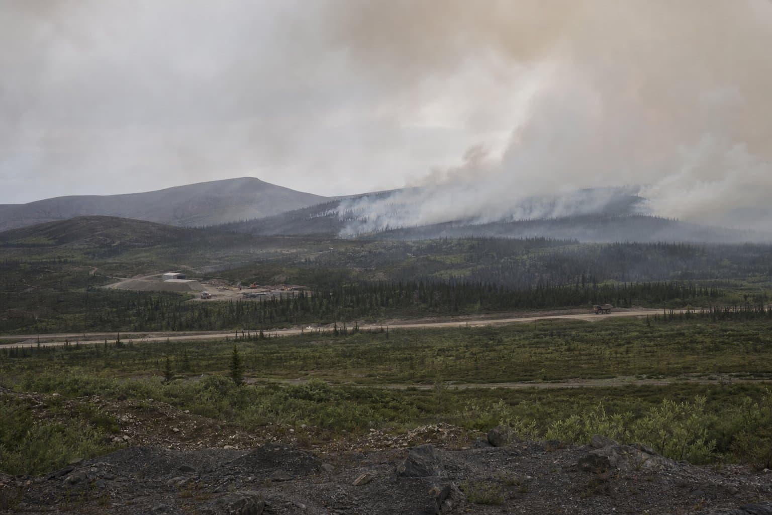
Residents near Wiseman, Dalton Highway travelers, and a mining operation to the north are seeing smoke and aviation activity as a lightning-caused wildfire about 5.5 miles northwest of Wiseman has grown to approximately 1,000 acres since it was discovered Thursday, July 9.
No immediate structure threats are reported.
The Nutmeg Fire sits inside a Limited Management Option zone. "Fires in these areas are monitored and allowed to perform their natural ecological role," the U.S. Wildland Fire Service said in a July 10 update. A reconnaissance flight initially estimated the fire at roughly 200 acres before it grew to about 1,000 acres, burning in brush and marshy areas south of Wiseman Creek.
Because of the fire's proximity to Wiseman, a mining operation to the north, and visibility from the Dalton Highway, managers sent two smokejumpers to watch fire behavior near Wiseman Creek and Nolan Road.
Fires in these areas are not automatically suppressed unless values at risk change.
Source: U.S. Wildland Fire Service monitors Nutmeg Fire northwest of Wiseman.
Made by our human newsroom with AI. How humans and AI work here · Grow with our newsroom
Stay informed. Support what matters.
Free, permanent access to local news you can verify. Subscribe to support Maggie AlaskaNews and go ad-free.
Related Coverage
Konedsin Minnkohwin Fire burns within Kanuti refuge near Allakaket
Alaska News · 2mo ago
New fire burns 1.5 miles from Native allotment near Kaltag
Alaska News · 3mo ago
Smokejumpers were called to a fire near a Kuskokwim homestead — then couldn't jump
Alaska News · 3mo ago
The smoke over Fairbanks is from a fire the state is choosing to let burn
Alaska News · 2mo ago
A wildfire is burning in protected caribou habitat in the Kanuti refuge
Alaska News · 3mo ago
Comments
Sign in to leave a comment.
No comments yet. Be the first to share your thoughts.