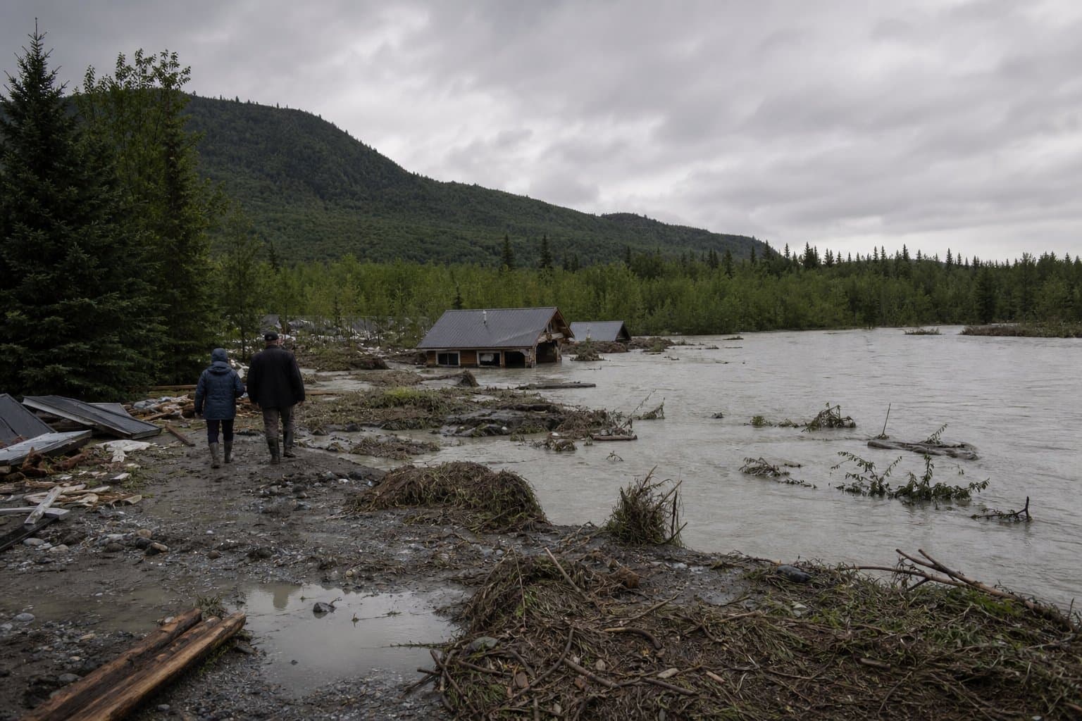
Home lost in Talkeetna as river crests at highest level since 2012
One home was lost and several structures were damaged in Talkeetna in flooding along the Talkeetna River, the Mat-Su Borough reported to the National Weather Service. The report was logged at 5 p.m. July 23 and relayed publicly Saturday.
The river's record
The Talkeetna River near Talkeetna crested at 13.07 feet, above the 12.5-foot minor flood stage and below the 15-foot moderate threshold. It is the highest crest at the gauge since September 2012.
Rick Thoman of the Alaska Center for Climate Assessment and Policy posted the crest figure Friday on Bluesky along with the rainfall behind it. "Talkeetna Airport reported 2.91 inches (73.9mm) rain in the 24 hours ending at 10am AKDT Thursday," Thoman wrote.
The National Weather Service in Anchorage issued a flood advisory for the Talkeetna River near Talkeetna until 3:15 p.m. Friday. It extended the advisory for the Yentna River near Lake Creek until noon Saturday. It also extended an advisory for Kroto Creek and Moose Creek near Oilwell Road until 10:45 p.m. Thursday after water was reported over the road.
The borough's emergency declaration
The borough assembly declared a local emergency and requested state support, saying in a July 23 release that it was acting "in response to imminent flooding threats in Talkeetna" to protect residents, infrastructure and property. Alaska News previously reported the Yentna River flooding lodge cabins as two Susitna Valley advisories ran through Friday. Forecasters described July as likely the wettest on record for the region, with flood watches covering Skwentna, Willow, Trapper Creek, Petersville and Chulitna.
Talkeetna sits at the junction of the Talkeetna and Susitna rivers. Residents have pressed the borough for permanent bank work. At the assembly's meeting earlier that week, Edna DeVries, whose property and business sit at the end of Main Street on the river, told members: "What we'd like to see is the dike extended to join the revetment, and the revetment built up to the stronger infrastructure and height of the dike. As it is now, we expect during the next flood, we're thinking that probably is going to wash away part of Main Street." She asked the assembly to approve the resolution and funding "so that it can be fixed now instead of the 5 to 10 year delay that the studies will take."
The hydrograph accompanying Thoman's Friday post showed the gauge trending downward after the crest, with a forecast issued the morning of July 24.
AI-assisted, reviewed by editors. Spot an error?
Comments
Sign in to leave a comment.
No comments yet. Be the first to share your thoughts.