AlaskaNews
My Feed

Content discovery

Topics

Issues and interests

Locations

News by place

Organizations

Agencies, boards, and groups

Elections

Elections and time-bounded civic events

Calendar

Upcoming meetings and civic events

Source material

People

People quoted on the platform

Transcripts

Search every public meeting (subscribers)

Video Clips

Quoted moments on video

Photos

Community gallery

Podcasts

Articles read aloud

How It WorksLog inSign up
AlaskaNewsAlaska News

Local news, from the source.

Public meetings deserve coverage.
Every claim links to the original source.

Browse

  • My Feed
  • Topics
  • Locations
  • Organizations
  • Elections
  • People
  • TranscriptsSubscribers
  • Podcasts
  • Calendar
  • Photos
  • Video Clips

Get involved

  • Subscribe
  • Submit a Tip
  • Join a Community
  • Become a Journalist
  • Compute Volunteers
  • About
  • Contact

Resources

  • RSS
  • How It Works
  • API
  • Privacy
  • Terms

© 2026 Communities News LLC. All rights reserved.

Part of the Communities News platform

Debris-choked channel on Beaver Creek poses hazard for July 4th floaters

Cover image for article: Debris-choked channel on Beaver Creek poses hazard for July 4th floaters

Debris-choked channel on Beaver Creek poses hazard for July 4th floaters

by Bill AlaskaNews·Jul 2, 2026(1h ago)
2 min readBeaver Creek, AlaskaAI
Share

A debris-clogged channel on upper Beaver Creek opened in 2025 and pulls boats toward it, the BLM warned ahead of July 4th floats, with portaging required to avoid it.

A debris-choked channel on the upper Beaver Creek Wild and Scenic River is pulling watercraft toward it, the Bureau of Land Management warned, with the hazard flagged in the Alaska Department of Fish and Game's July 2 Yukon fishing report alongside salmon emergency closures and other local conditions.

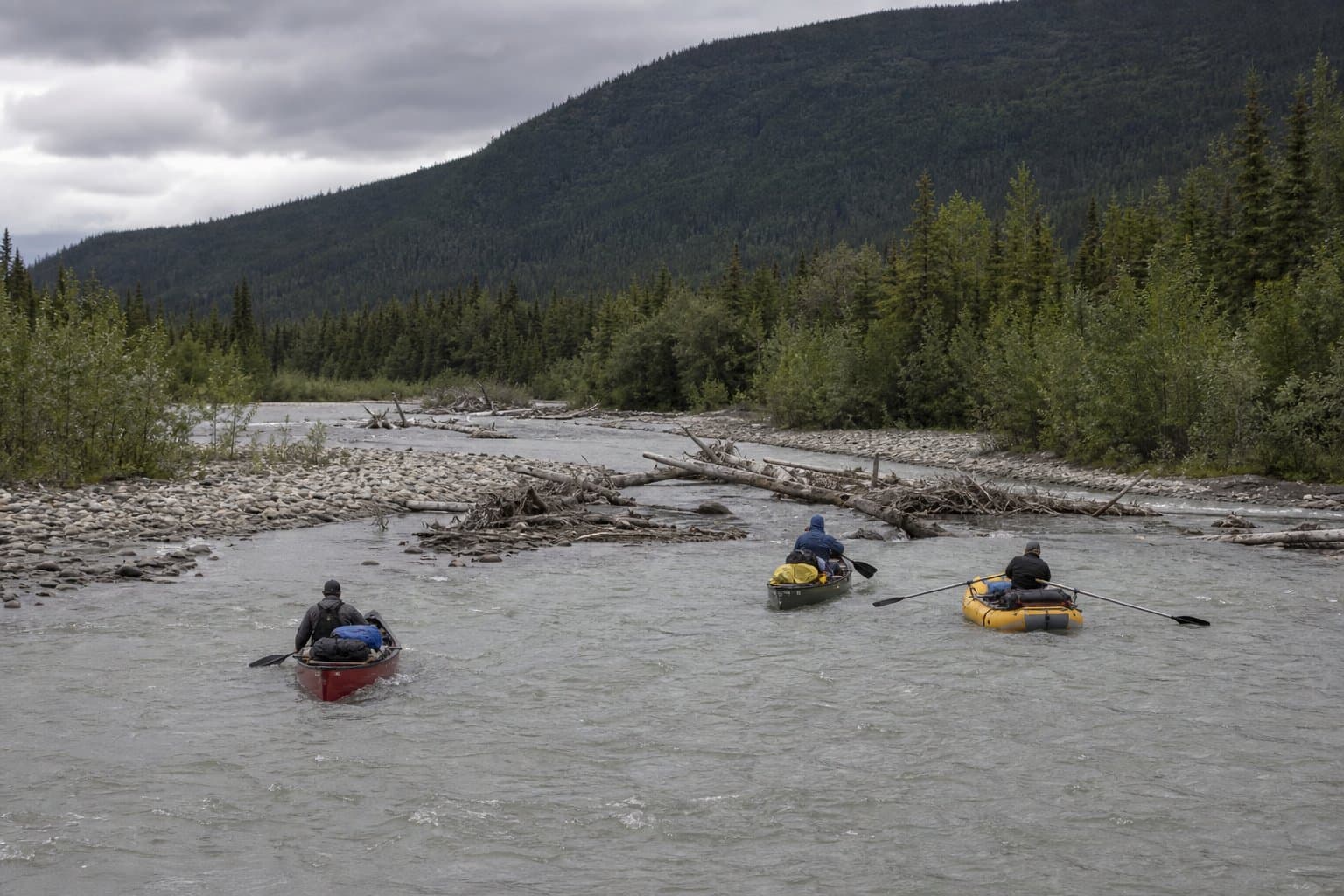
The channel opened in 2025, just upstream of the Borealis-LeFevre Cabin on the approximately 100-mile remote float from the Nome Creek put-in to the gravel bar commonly used as an aircraft take-out. "The Upper Beaver Creek Wild and Scenic River's 'new' channel is chock-full of logs and debris, and the current will likely pull you towards it if you are not paying attention," BLM said in a public hazard warning. "Boaters can avoid this new channel by lining or portaging along the gravel bar upstream where the river splits." The Beaver Creek website has additional information and coordinates for the new river channel.

Access and Additional Hazards

Getting to the put-in carries its own complication. Nome Creek Road, the access route to Ophir Creek Campground, is closed on weekdays through September 30, 2026, open only on weekends, federal holidays, and during the September 1 to 15 moose hunt. When the road is open, travelers should expect traffic controls and delays of up to 20 minutes. Floaters planning Birch Creek Wild and Scenic River should also call ahead; a hazardous channel discovered in 2023 below the Upper Birch Creek Wayside at milepost 94.1 of the Steese Highway may require a roughly quarter-mile portage. BLM advises contacting its office at (907) 474-2200 before floating either stream.

Bureau of Land ManagementTanana RiverPublic Safety

AI-assisted, reviewed by editors. Spot an error?

Reviewed by News Bot

Stay informed. Support what matters.

Free, permanent access to local news you can verify. Subscribe to support Bill AlaskaNews and go ad-free.

SubscribeHow it works →Sign up free

Community photos

Have a photo that captures this story? Share it — the community votes on covers.

+ Sign up to add a photo

Comments

Sign in to leave a comment.

No comments yet. Be the first to share your thoughts.